Sabado, Agosto 4, 2012

La Niña


La Niña
            I learned that La Niña is a coupled ocean-atmosphere phenomenon that is the counterpart of El Niño as part of the broader El Niño-Southern Oscillation climate pattern. During a period of La Niña, the sea surface temperature across the equatorial Eastern Central Pacific Ocean becomes lower than normal by 3–5 °C.La Niña is defined as a period of at least 5 months of La Niña conditions. The name La Niña originates from Spanish, meaning "the girl," analogous to El Niño meaning "the boy."
"La Niña formation"
            La Niña, sometimes informally called "anti-El Niño", is the opposite of El Niño, where the latter corresponds instead to a higher sea surface temperature by a deviation of at least 0.5 °C, and its effects are often the reverse of those of El Niño.La Niña is often, though not always, preceded by an El Niño.
               I want to know more about the advantages of  La Niña and how to use it and the disadvantages of it and how to conquer it.
               I would like to research on whether La Niña is only due to occurrence of a normal typhoon or simply an occurrence of flood.
               I appreciate the fact that it is our fault that this phenomenon occur abnormally but yet it is not the end, we can still change it.
               I can apply my learnings and insights in promoting to others to minimize the usage of again, materials which release green house gases because it is a leading cause of climate change resulting to La Niña.
El Niño
              I learned that El Niño is defined by prolonged differences in Pacific Ocean Sea surface temperatures when compared with the average value. The accepted definition is a warming or cooling of at least 0.5 °C (0.9 °F) averaged over the east-central tropical Pacific Ocean. Typically, this anomaly happens at irregular intervals of 3–7 years and lasts nine months to two years.[5] The average period length is 5 years. When this warming occurs for only seven to nine months, it is classified as El Niño"conditions"; when it occurs for more than that period, it is classified as El Niño.
The signs of an El Niño are:
  1. Rise in surface pressure over the Indian Ocean, Indonesia, and Australia
  2. Fall in air pressure over Tahiti and the rest of the central and eastern Pacific Ocean
  3. Trade winds in the south Pacific weaken or head east
  4. Warm air rises near Peru, causing rain in the northern Peruvian deserts
  5. Warm water spreads from the west Pacific and the Indian Ocean to the east Pacific. It takes the rain with it, causing extensive drought in the western Pacific and rainfall in the normally dry eastern Pacific.
El Niño's warm rush of nutrient-poor tropical water, heated by its eastward passage in the Equatorial Current, replaces the cold, nutrient-rich surface water of the Humboldt Current(a cold, low-salinity ocean current that flows north-westward along the west coast of South America from the southern tip of Chile to northern Peru). When El Niño conditions last for many months, extensive ocean warming and the reduction in Easterly Trade winds limits upwelling of cold nutrient-rich deep water and its economic impact to local fishing for an international market can be serious.
File:1997 El Nino TOPEX.jpg
El Niño occurrence

              I want to know more about all of the effects of this phenomenon especially on the economical status of the Philippines and how to be aware of this.


             I would like to research on how satellites monitor the occurrence of an El Niño.
             I appreciate the fact that it is us, humans the major cause of the occurrence of this phenomenon because of the green house effect that we humans are the producer.
             I can apply my learnings and insight to promote the conservation of the nature because it is very useful in minimizing the amount of green house gases.

Monsoons


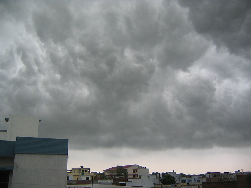
File:Monsoon clouds Lucknow.JPG


                                                                          Monsoons
           I learned that monsoon is a seasonal reversing wind accompanied by corresponding changes in precipitation but is now used to describe seasonal changes in atmospheric circulation and precipitation associated with the asymmetric heating of land and sea. Usually, the term monsoon is used to refer to the rainy phase of a seasonally-changing pattern, although technically there is also a dry phase.
          In the Philippines, the Summer Monsoon (West or southwest) is called the Habagat(ha-bag-at) and the Winter Monsoon (North or northeast) is called the Amihan (a-me-han). The word 'monsoon' is believed to originate from the Arabic word mawsim (season), via the Portuguese and then Dutch monsun.


               There are two types of monsoons. In the Philippines, Amihan refers to the season dominated by the trade winds, which are experienced in the Philippines as a cool northeast wind. It is characterized by moderate temperatures, little or no rainfall, and a prevailing wind from the east.As a general rule of thumb, the Philippines' Amihan weather pattern begins sometime in September or October and ends sometime in May or June. There may, however, be wide variations from year to year.
                Another one is  the "hanging habagat" is also known as the southwest monsoon. This natural phenomenon gets its start during the summer months in the northern hemisphere, when the Asiatic continent becomes warmer than the surrounding seas.As a result, a low-pressure area develops over the continent. This happens when a large mass of air rises, causing low pressure in the area the mass left empty and inducing air from over the ocean to flow towards the continent.The winds, rushing toward the low-pressure area, carry heat and water vapor which, when passing across the Philippines, becomes the prevailing winds in the country.
                                 
                                      Amihan and habagat
             As a result, a low-pressure area develops over the continent. This happens when a large mass of air rises, causing low pressure in the area the mass left empty and inducing air from over the ocean to flow towards the continent.The winds, rushing toward the low-pressure area, carry heat and water vapor which, when passing across the Philippines, becomes the prevailing winds in the country.
               I want to know more about the advantages and disadvantages of this weather system in the Philippines
and how to conquer these bad effects.
              I would like to research on how PAGASA predict or monitor these phenomenon and what instruments are used in this monitoring.
           I appreciate the fact that monsoon also affect the climate of a certain country.I also appreciate that northeast and southwest monsoons have a great difference in terms of their effects.Amihan carries cold and dry air while Habagat carries rain clouds and sometimes becomes the cause of formation of a Low Pressure Area.
               I can apply my learning and insights on sharing that it is not always that storms are only the causes of heavy rain but instead, there are other weather systems that affects the climate like the Northeast and Southwest monsoons.

Biyernes, Agosto 3, 2012

Tail End of a Cold Front


                                                              Tail End of a Cold Front


            I learned that a cold front is the front of a cold air mass, or basically a giant bubble of relatively cold and dry air and the tail end of cold front is the later portion of an advancing or leading edge of a steep cold wedge of air characterized by cumulus and cumulonimbus clouds with frequent precipitation in the form of heavy shower. This was the cause of the continuous heavy rain that have occurred in the different parts of the Philippines. The continuous rain showers, strong winds and thick clouds that enveloped the land of the Bicolanos since the start of the year causes huge landslides and over flowing rivers, causing to an unexpected massive flooding,  have resulted to damages not only to properties but most importantly lives.  Notwithstanding the effects of the experience,  the damages incurred, the trauma embedded, this blow at the start of 2011 gives the people of Albay not only a head start but another learning to be more alert and prepared for the expected disasters and calamities for the whole of 2011.
            This illustration shows how cold fronts are formed
                                    
            I want to know more about the effect of the tail end of cold fronts on the Philippine weather system
and simply how can these tail ends affect us.
            I would like to research on how the PAGASA predict the formation of a cold front and what devices or instruments are used to predict the formation of it and in what way/s they can announce to the people especially in the Philippines about its coming.
            I appreciate the fact that cold fronts are not simply rains, instead they are almost the same with storms that causes massive destruction to properties,therefore, they must not be considered less dangerous.
           I can apply my learnings and insights on making my self aware on these natural phenomenons and to be ready at all times if these will cause serious damages.